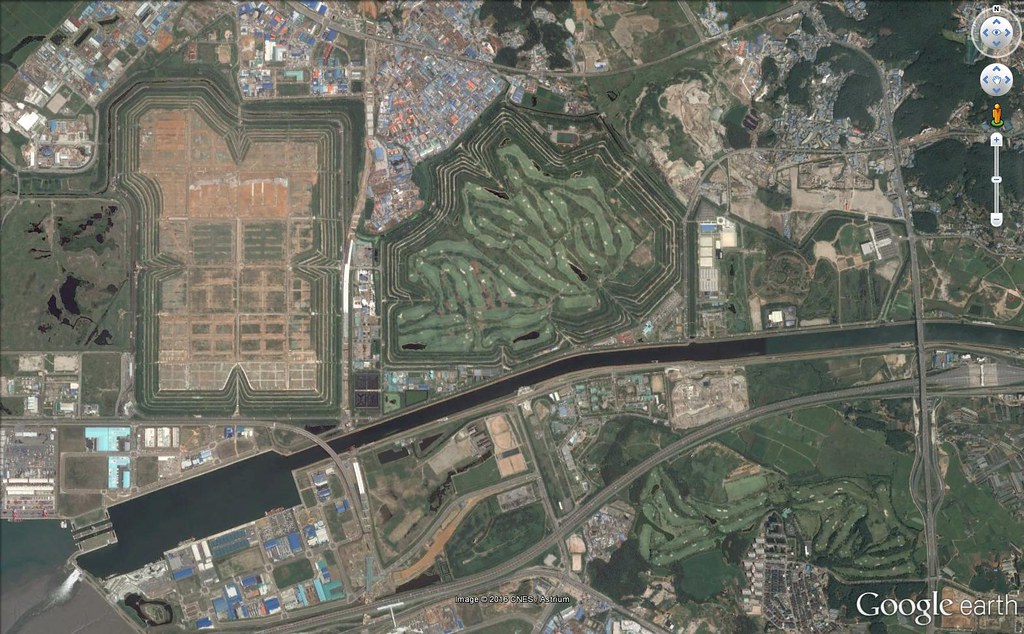
This place is going through a really significant transition in terms of use. Here’s what it looked like in 2003:


The Online Geography Game
This place is going through a really significant transition in terms of use. Here’s what it looked like in 2003:
Well, this contest started out with this reveal:
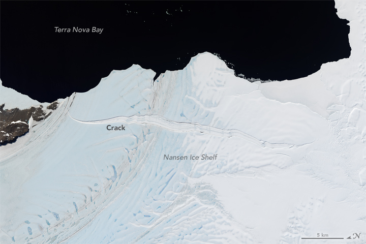
In December of 2015, scientists at the USGS and NASA noticed a crack in the Nansen Ice Sheet (also known as an Ice Shelf). Nansen is named after Mount Nansen, which, in turn, was named after Fridtjof Nansen, a noted polar explorer who, later in life, was the League of Nations High Commissioner for Refugees, an office that eventually won him the Nobel Peace Prize in 1922.
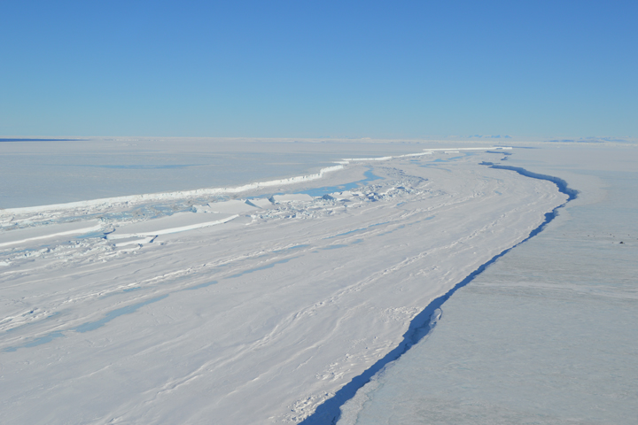
“The front of Nansen Ice Shelf… looks ready to calve off into a tabular iceberg,” wrote Ryan Walker, a researcher at NASA Goddard, on a blog for NASA’s Earth Observatory. “There’s a huge crack, miles long and sometimes over a hundred yards wide, which runs more or less parallel to the front of the ice shelf.”
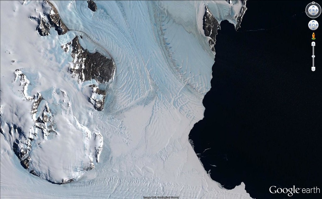
However, best laid plans of mice and men… it seems that the picture also contains “Inexpressible Island”, where part of Scott’s “Terra Nova Expedition” got stranded and wintered in 1912.


What Campbell’s part ate…
There were still a few others that found this via the Drygalski Ice Tongue.
Basically, we gave the points if you found the spot, regardless of why…
Those who found the iceberg before it fell include:
And those who needed a hint:
And … thus ends yet another series. Congratulations to perennial favorites Phil Ower and Lighthouse, both with just 1 point away from perfect. That’s quite a streak for Lighthouse — this is the 8th continuous series with you sharing top spot!
The original target of this contest is named after a Nobel Peace Price Laureate. Well, named after a mountain that was named after a Nobel Laureate. It’s a place that’s likely to not be there soon.
Apparently, the thing most people that got it are focusing on is a different part of the picture where a group of people spend a particularly miserable winter in 1912.
The switchback road you see was part of Route 66, from 1926-1937. For a while Route 66 ran through downtown Santa Fe. After 1937 the route ran considerably straighter through the middle of Albuquerque, mostly along the present Central Avenue. Central Avenue and Fourth Street are a crossroads where the pre- and post- 1937 alignments of Route 66 cross each other.
The switchback that is the subject of this weeks quiz is about 5 miles west of the present La Bajada hill (considerably straighter) on Interstate 25. The old road pre-dates Route 66 by quite a bit (1598!), going back to El Camino Real, the road from Mexico City, to Santa Fe, then the provincial capital of Northern New Spain.
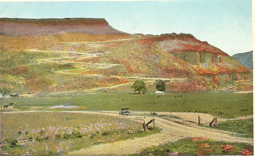
La Bajada in 1875- wagons coming down;

Old and new, date unknown

Back when, early automobile traffic:

Two headed down, one going up:
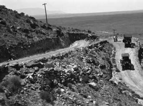
Mid-1920s.
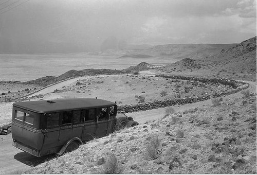
Bus service! Late 1920s, early ’30s.
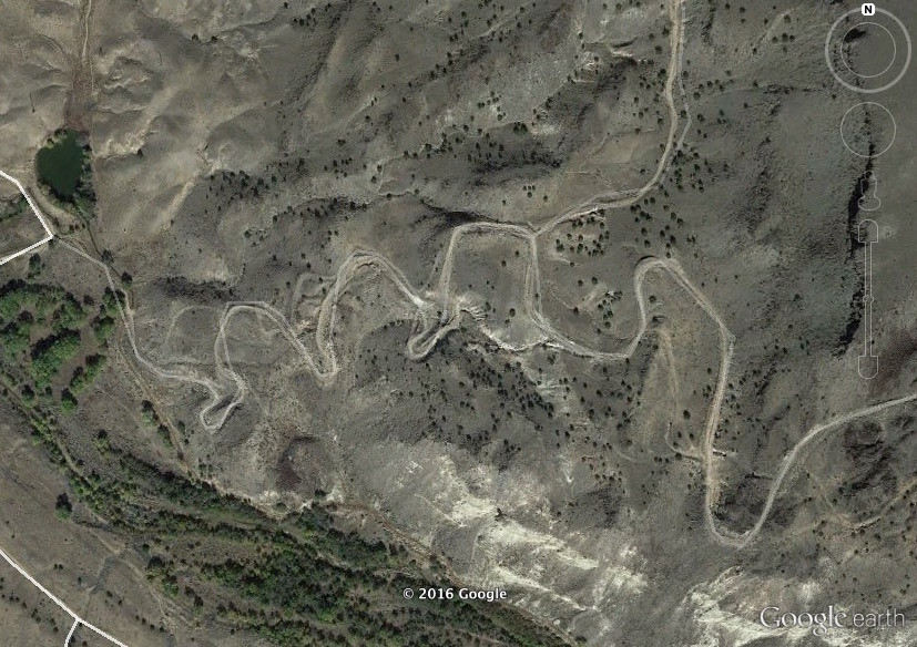
Now long disused, but the subject of lots of attention. Present day video:
Those got their kicks before the hint:
Those who needed the oldest Rand McNally Road Atlas

https://www.youtube.com/watch?v=dSzGoJcVVg0
You have to remember that the route in question, particularly pre-WWII, was subject to frequent re-alignments as highway engineers sought the best route across the western United States.
When the Soufrière Hills volcano in the center of Montserrat, an island in the Caribbean, began to erupt in August of 1995, the capital city of Plymouth was immediately evacuated. The city itself was mostly spared, so people were let back in Over the course of the next 2 years, the eruption continued off and on and each time a pyroclastic or mudflow would form and threaten Plymouth, the city was emptied out again until it was deemed “safe” to return. In 1997, the call to return never happened. The city was hit full force by lava, ash, and mud, and was buried, 20 meters deep in some parts of the city. The southern 2/3 of the island was declared an “exclusion zone”, which still exists today. Now, the only way to visit Plymouth is by helicopter tour from Antigua (which has become a fairly popular cruise port excursion).
Here’s some video of what Plymouth looked like before it was destroyed
And here’s what it looks like today:
Those who dodged the first pyroclastic flow included:
And those who had to have help to evacuate (after the hint):
When Justin Bieber was born, this was the capital of its country. By the time Princess Diana died, it looked like this.