
Longest in the world, but be careful where you step.
Contest #497
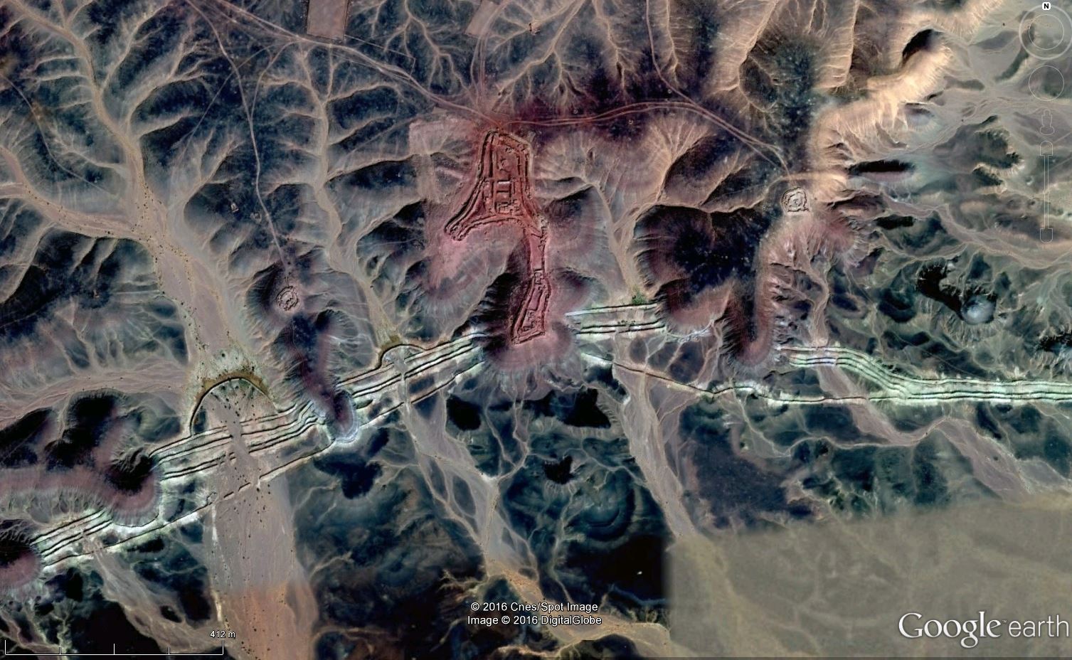
Contest #495 the site of the former refinery near Sunburst, Montana, USA
This image with the rings stood out to me as an interesting location – what resulted in the rings? Natural, man-made?
After some investigation, it turned out to be the site of a refinery built to serve the small oilfield discovered just southwest of the town of Sunburst, Montana in the USA.
Built in 1924, it operated until 1961, after it was discovered that oil was leaking from pipes and getting into houses in the town.

Found before the oil ran dry (or in this case underground):
- Glenmorren
- Garfield
- Phil Ower
- Lighthouse
- Lelie
After the hint:
- no one
Contest #495 Hint
Like a leaky bucket led to its closure?
Contest #495
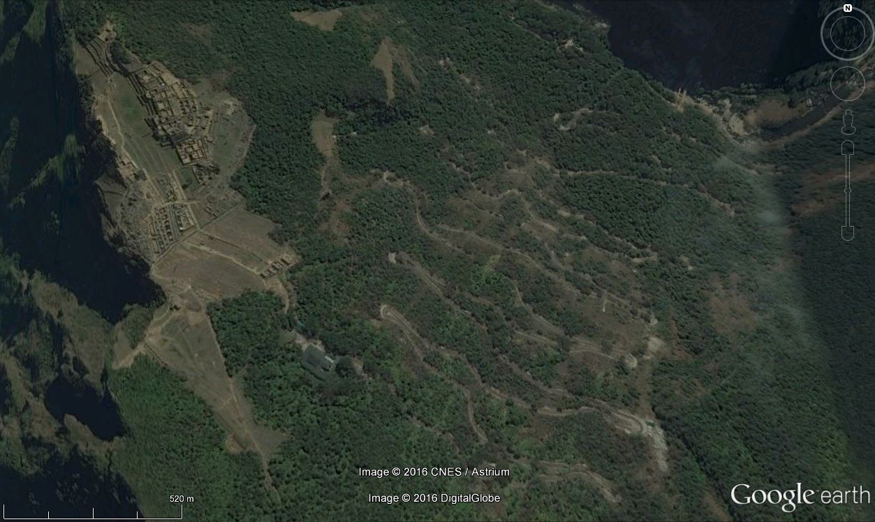
Contest #493: Machu Picchu, Peru
Machu Picchu in southern Peru is believed to be an estate for the Inca emperor Pachacuti (1438–1472). It is the most familiar icon of Inca civilization. The Incas built the estate around 1450 but abandoned it a century later at the time of the Spanish Conquest. Although known locally, it was not known to the Spanish during the colonial period and remained unknown to the outside world until American historian Hiram Bingham brought it to international attention in 1911.
Machu Picchu was built in the classical Inca style, with polished dry-stone walls. Its three primary structures are the Inti Watana, the Temple of the Sun, and the Room of the Three Windows. Most of the outlying buildings have been reconstructed in order to give tourists a better idea of how they originally appeared.
Machu Picchu was declared a Peruvian Historical Sanctuary in 1981 and a UNESCO World Heritage Site in 1983. In 2007, Machu Picchu was voted one of the New Seven Wonders of the World in a worldwide Internet poll.


Found, not by the Spanish in the 16th Century, but by:
- Glenmorren
- Phil Ower
- hhgygy
- Lighthouse
- Eloy Cano
- Garfield
- MEHMET Durmus
- Lelie
- Jeather
- Rob de Wolff
- Jesus Rodriguez
- joe9000
- Luís Filipe Miguel
- donaaronio
- RicardPG
- Tuxedo Jones
After the hint:
- Ben S
- Ashwini Agrawal
- Chris Nason
- Declan Moore
- LawnBoy
- Robin
- Skip
Contest #493 Hint
One of the New Seven!
Contest #493
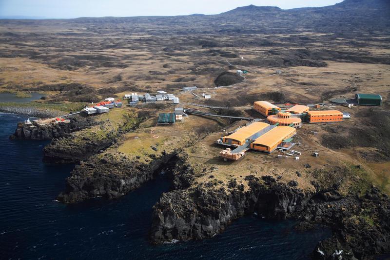
Contest #489: Marion Island, South Africa
After discovering that we had inadvertently included the latitude and longitude of the first image for contest #489, we quickly replaced it with a substitute image – showing Marion Island in the southern Indian Ocean.
There are two islands in the Prince Edward Islands group: Marion Island and Prince Edward Island. Discovered by the Dutch but misplotted (at 41S, not 46S), they remained unvisited until again “found” by the French in 1772 who thought they might have found Antarctica. Neither party was able to land – and the first recorded landing was not until 1799 when a group of sealers set foot on land. The hint referred to the fact that it is difficult to get to the island (boat or helicopter) and several parties have been stranded on the island with no easy way to get off.
In 1947, South Africa annexed the islands and established a meteorological station on the northeast shore. The station was enlarged and eventually replaced by a new research base in 2011. The two islands are now part of a Special Nature Reserve and Marine Protection Area.
As you can see, the island is volcanic in nature, with the Mascarin Peak at 1242 metres above sea level an active volcano with eruptions occurring from time to time.
The research base – old on the left and new on the right.
Found for 2 points, despite a bit of deception on our part:
- Glenmorren
- Eloy Cano
- hhgygy
- Lighthouse
- Phil Ower
- Garfield
The following players get 2 points for finding the first location before the image was quickly removed, and perhaps not visiting the site since.
- Ben S.
- Robin
- Jeather
Contest 489 Hint
If you get here, you usually have lots of time to explore… lots and lots of time without an easy escape.